The Yemen War In 7 Maps
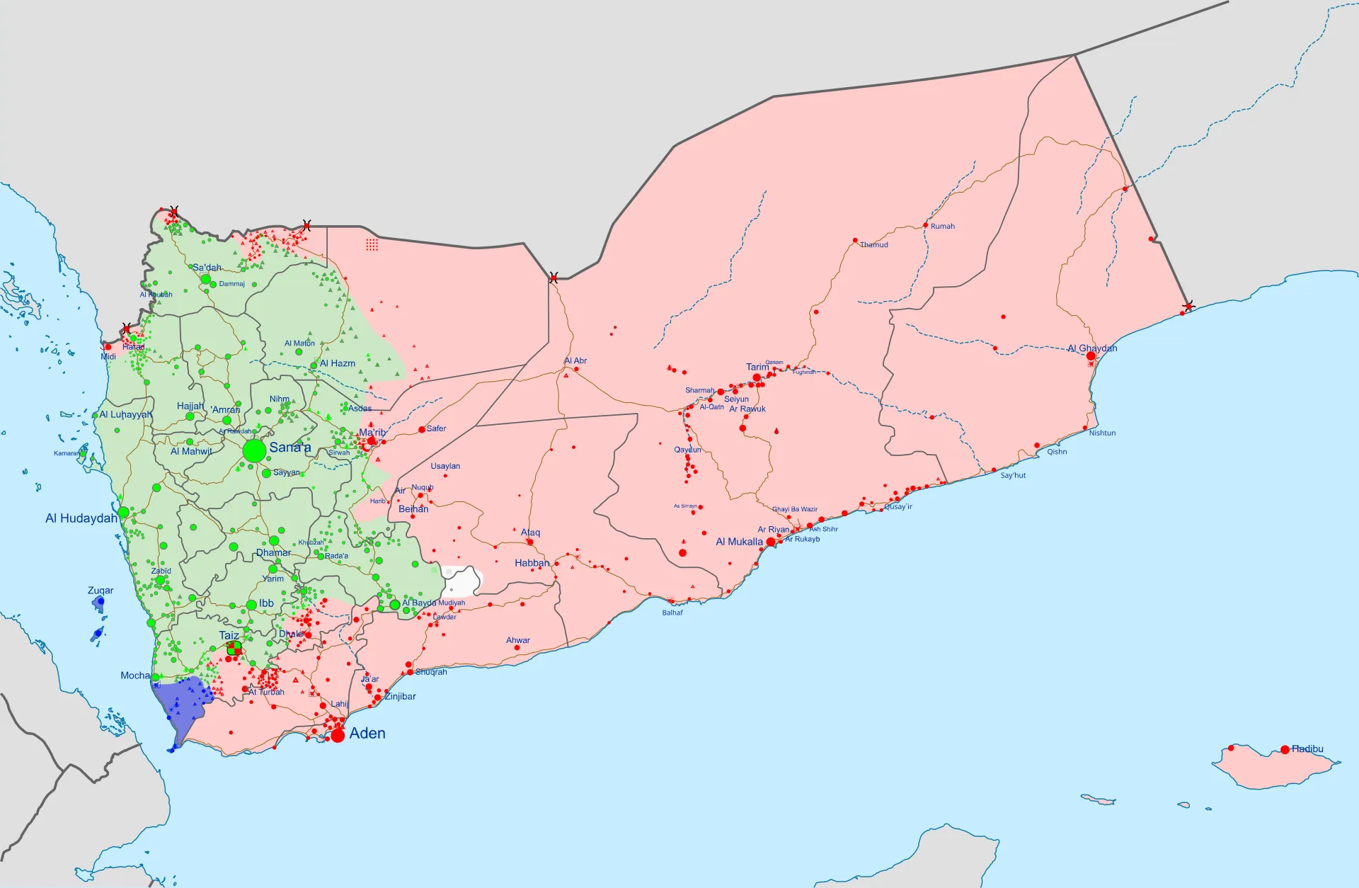
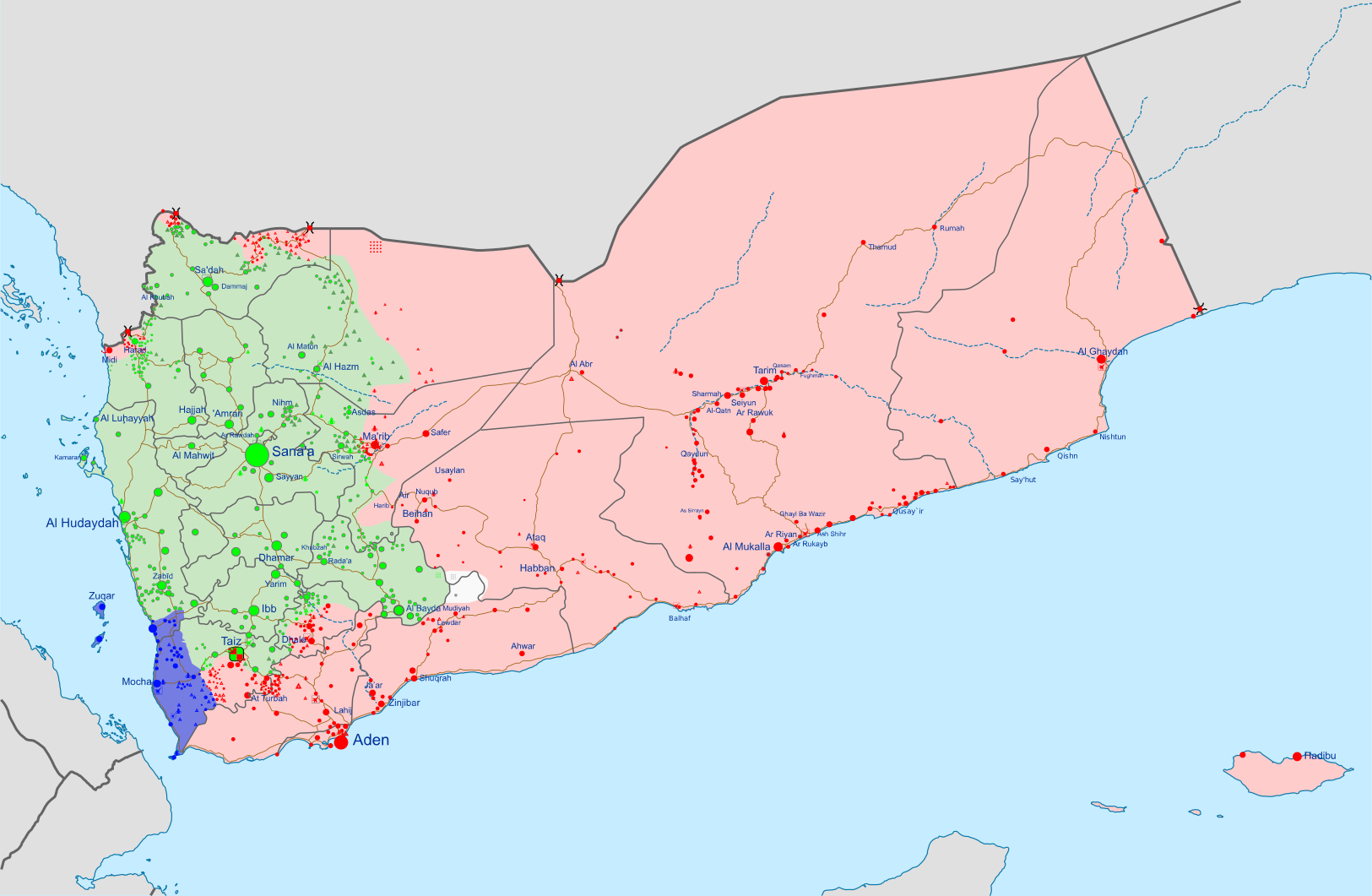
The fog of war around Yemen is very strong, but all reports are that they have taken Mocha on the coast. As I edit this there's reports that Ansarallah has already liberated the whole coast, it sounds like a rout. Mocha alone is important because it's A) the birthplace of mocha coffee (as Gaza is the source of gauze) and B) was the last White Empire port on the West coast. The Resistance has taken it, by all accounts. They are now (were then?) about 75km from the Bab el-Mandeb by foot. They already control it by rocket science.
The Fog
The snake, the rat, the cat, the dog
How you gonna see 'em if you livin' in the fog
– DMX
I mention the fog of war because Ansarallah is usually very transparent. Yemeni Armed Forces spox Yahya Saree is on Telegram. He posts infographics in English. On the 8th of September (26 Rabi) he only mentions bombing Saudis, which is basically a slow Tuesday. But this was the same day major ground battles were raging.
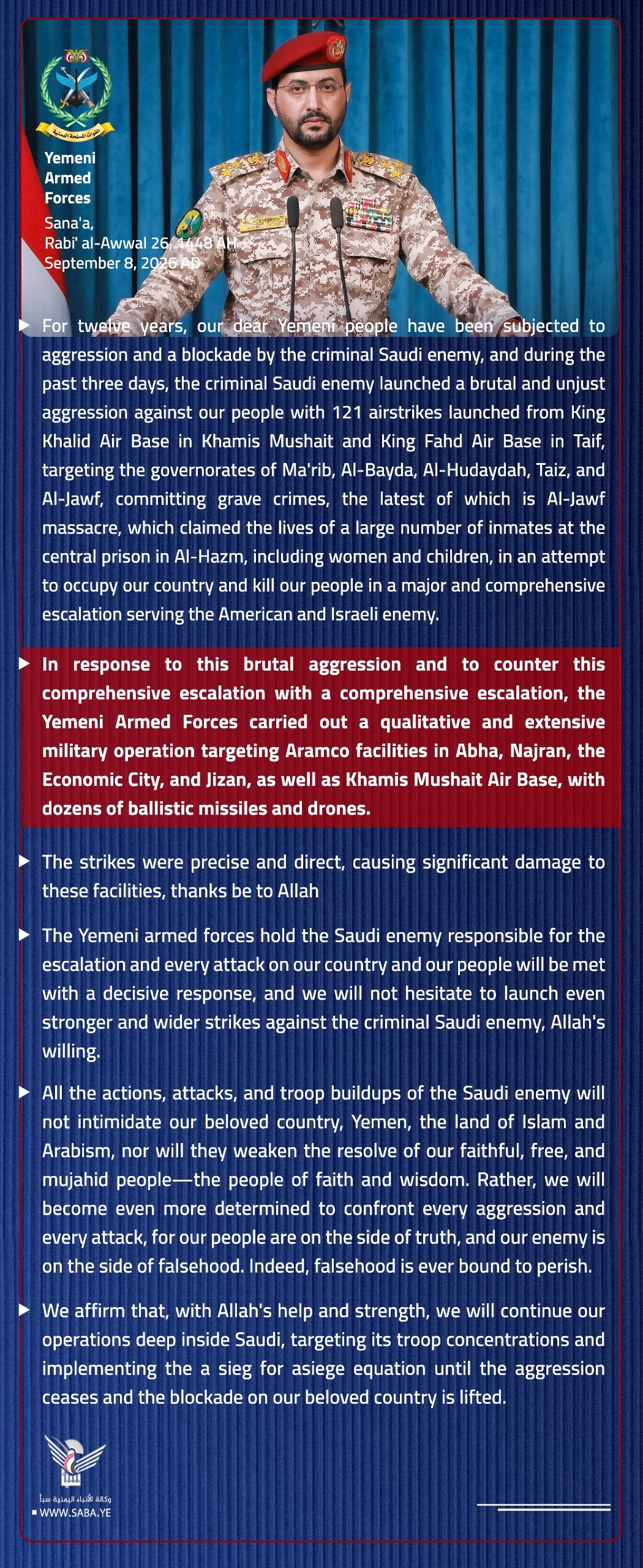
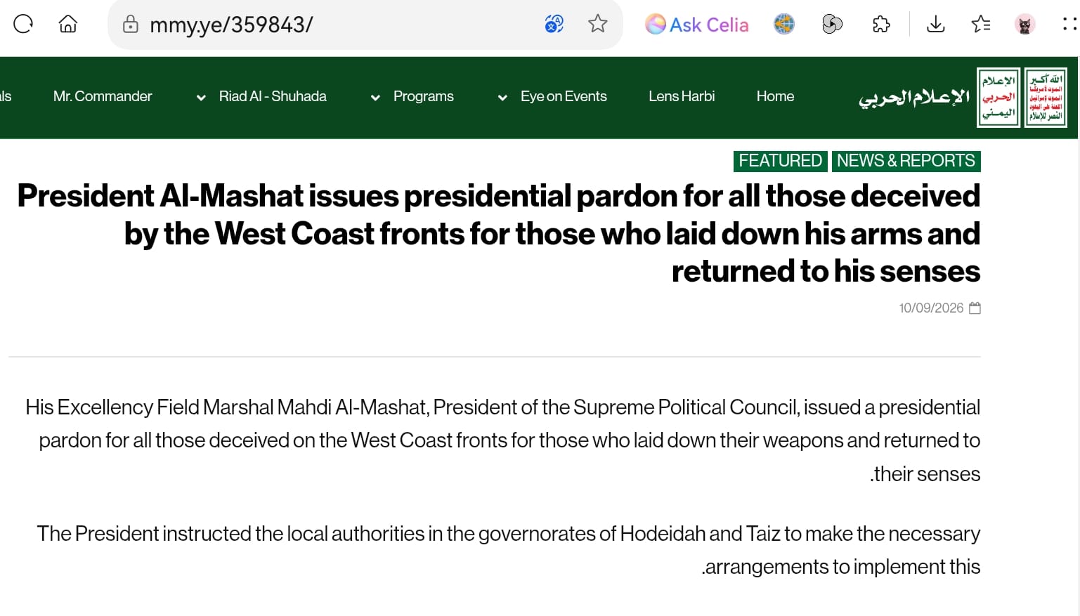
This is radio silence obviously on purpose, it's a fog machine. Someone used faked audio of proxy comprador Tariq Saleh telling his troops to withdraw to... get troops to withdraw. At the same time the Yemeni President and fellow Transitions lenses enjoyer (I told you it was cool, Shruthi) Mahdi al-Mashat has, "issued a presidential pardon for all those deceived by the West Coast fronts for those who laid down his arms and returned to his senses."
The White media reports that, "Houthi militants have taken control of the Yemeni Red Sea city of Mocha and are launching attacks on the strategic Red Sea islands of Hanish, the Yemeni sources told Reuters on Thursday." The station inside a US military base (Al Jazeera) acknowledged as much,
The Al Jazeera reporter keeps saying 'internationally recognized government of Yemen' meaning the imperial satraps operating out of a hotel in Riyadh. They keep calling Ansarallah A) Houthis and B) rebels against the Yemeni government when they are the enemy government and are rebels against the Empire.
But enough unexplaining, if you don't get it by now, forget it. For a bit of a palate cleanser, here's 'pro-Houthi' (meaning anti-genocide) journalist Hussain Albukhaiti putting things in context:
Albukhati makes a point that Yemen is not trying to take the Bab el Mandeb, they're liberating Yemen. He also points out that Yemen controlled the Bab el Mandeb already. But still, it's good for the mandem to have Mandeb. They can squeeze the Empire's nuts at a range of 50 km instead of 150 km. And the narrow sailing channel is just 10 km. They can just sit there and pop khat and pop gats.
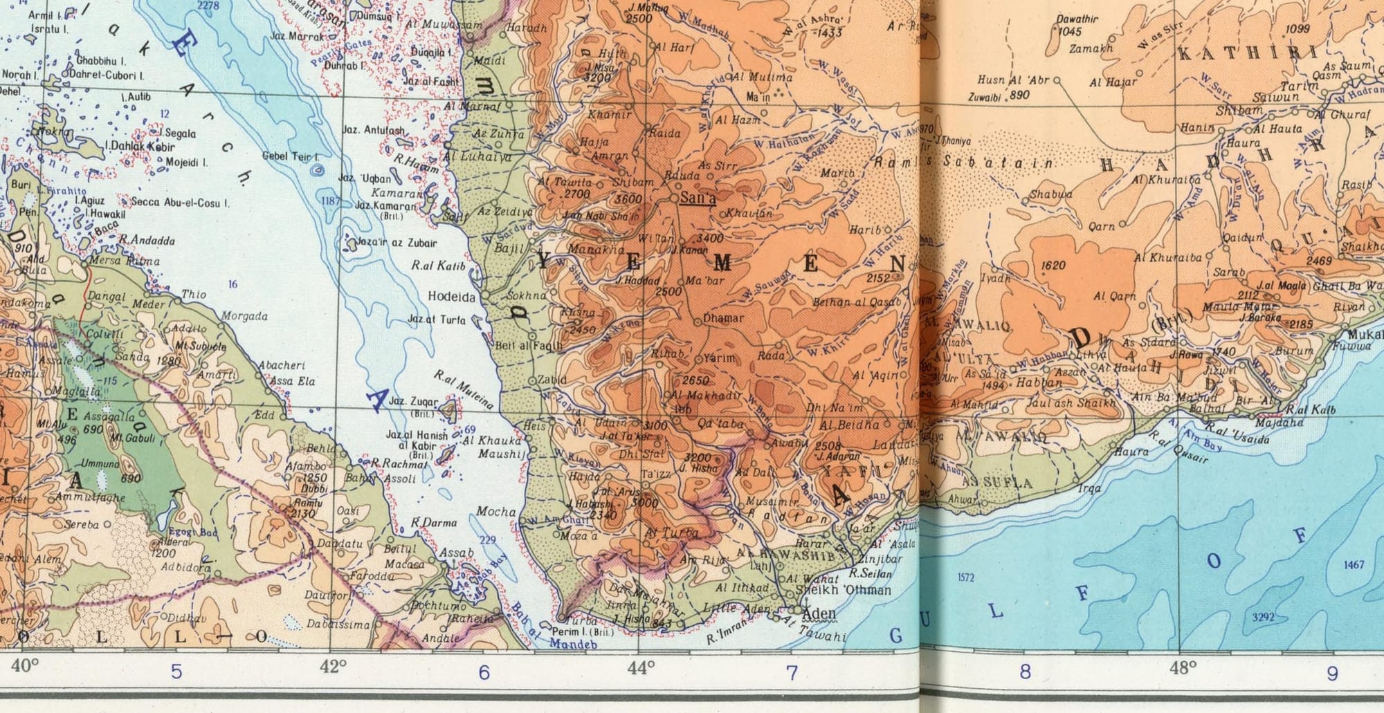
Of course, the Saudi boys still have enough toys to blow Yemenis out of the water. But Yemen is, again, not Iran and has shown that they will absolutely ravage the Saudi oil infrastructure at the slightest provocation. And this is all the Saudis got. Pumping Mesozoic oil to buy 20th century weapons, and doing lines in the desert. But every time the use weapons, it blows up their own oil. Escalation is a self-tightening knot. The more they pull on it, they less they've got.
The War
Y'all been eatin' long enough now, stop bein' greedy
Just keep it real, partner, give to the needy
Ribs is touchin', so don't make me wait
Fuck around and I'm gon' bite you and snatch the plate
– DMX
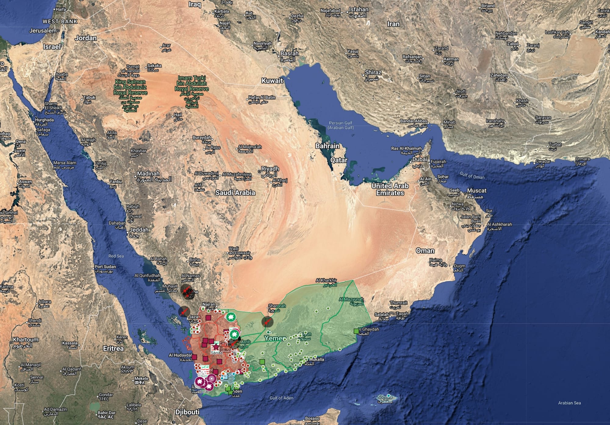
This is what we can see through the fog. What is known is that Yemen good and White Empire bad. And that the real Yemen is led by Ansarallah in Sanaa, not out of a hotel in Riyadh. When the 'internationally recognized' Yemeni Defense Minister set foot in Yemen, his car was set on fire and he's disappeared (reportedly). They don't seem to recognize him.
Abdul Malik al-Houthi is the leader of Yemen and his movement, Ansarallah, has 80% of the population in a third of the land. They hold the capital Sanaa and surrounding mountains. Their motto is, "God is the Greatest, Death to America, Death to Israel, Curse be upon the Jews, Victory to Islam." This might have sounded out there pre-genocide, but yeah, it's true.
The White Empire has tried to starve them out (you know the genocidal drill), and their servants the Saudis have gotten other servants to attack Yemen for years. '“Keep Yemen weak”, King ‘Abd al-’Aziz allegedly advised his sons on his deathbed in 1953,' and that's what those weak leaders have been doing since. But the servant of a servant is a master of no one, and these proxies of a proxy have been defeated. According to Al Jazeera (itself a proxy), there was little fighting in Mocha because the farces had already scattered and fleed. Good riddance. Saudi was genociding Yemen for years.
For years Saudi has kept food, flights, and freedom from Yemen. Only pre-approved people were allowed to fly in at all. When Iran broke this siege by sending civilian planes, the Saudis bombed the airport, which set all this off. As al-Houthi said (he's great, one of the last standing fighter philosphers), "Freedom is our religion. We will be slaves to no one but God. But the Saudi wants us to eat, move and trade only by his permission – damn him. We are free." This is a paraphrase, I invite you to full phrases. He is one of the last philosopher kings left standing.
Ansarallah is not like Iran in the sense that they did not wait to get struck. They immediately started blowing mercenaries and supply depots up. The mercenaries could not advance because they could not mass forces at all. At the same time, Yemen kept striking Saudi refineries, taking lakhs of barrels of oil off the market and hitting the White Empire in its second wobbly knee, the Red Sea.
What It Means
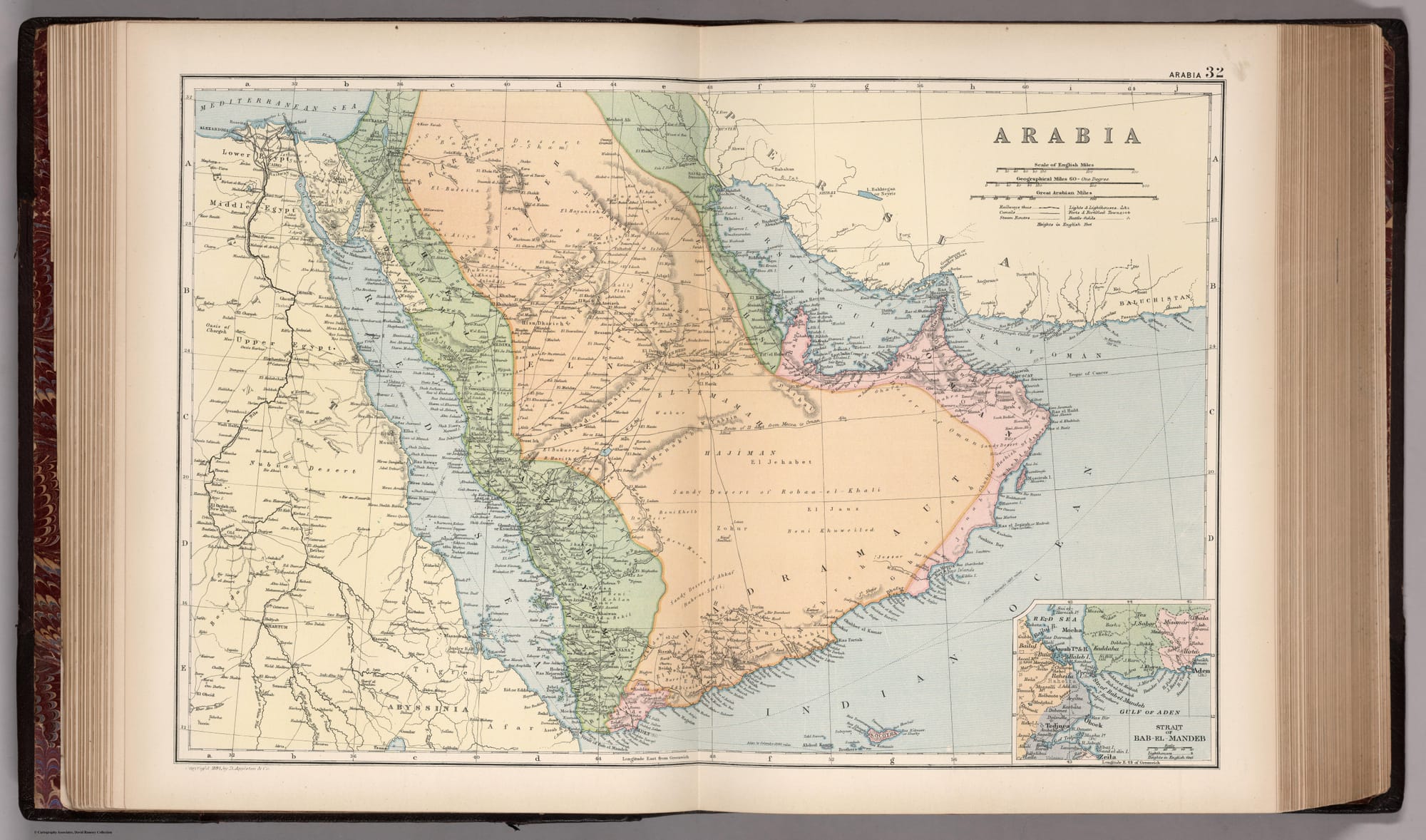
If we are going to clear the bong of war, then what is this all for? For the liberation of Yemen, yes, but what is Yemen? What are any of these lines drawn on a map by colonizers, to divide and conquer? For example, this old map from 1892 has some completely different borders, which roughly match up to the current divide in Yemen. Why not let Yemen have Mecca and Medina? They're certainly be better custodians than these Saudi wastemen.
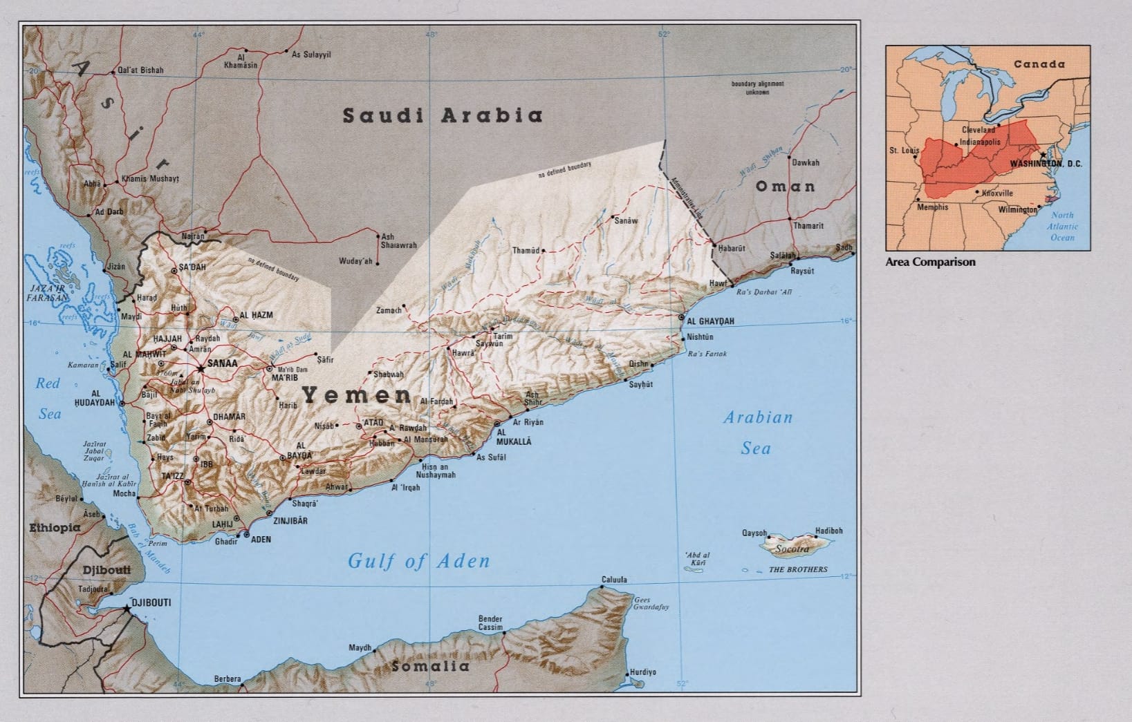
If we look at more modern (1990s) CIA maps – with Cleveland for scale for Americans – you can see the problem for the White Empire. The east barely has borders and can be easily gobbled by the Saudis, but the west is full of mountains. Indeed, precisely what happened is that Saudi was able to come from the east and gobble up the western coast, but they minute they faced any serious resistance, they ghosted. And they needed that bit of western coast, they were getting resupplied through Mocha. It will be hard to hold this open land, but if Ansarallah can, the sellouts won't be able to hold out much longer. The besieged become the besiegers. That's the 'tyranny of topography'.
The White Empire faces this geographic problem in two locations, the Bab el Mendeb and the Hormuz Strait, collectively forming its Suez Crisis. The CIA was also well aware of this, as they showed in the following illustration:
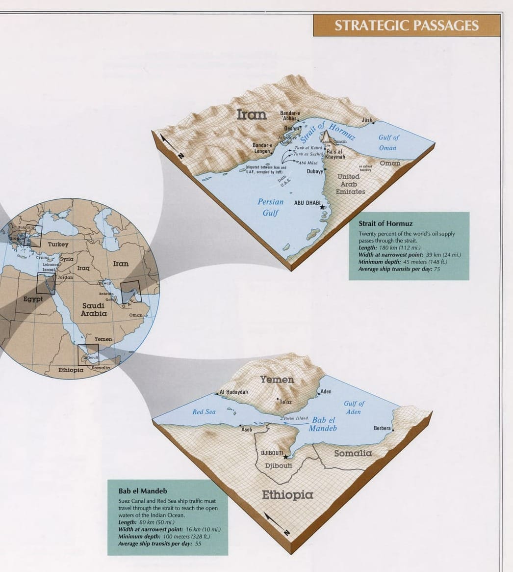
I honestly love it, they don't make government agencies like this anymore. The CIA today is doing memes and losing to kids playing with LEGOs. You can see the logical and topographical problem in this illustration clearly. The straits are narrow and the mountains are high. If you don't control either, you're going to die, inshallah. And if the Empire dies, people can live. Yemen has bled and starved for this day, and it's close.
Bonus maps for paying chaps: